

On this page
- The Spanish Pyrenees in 2026: What’s Changed and Why It Matters
- The Best Hiking Trails in the Spanish Pyrenees
- Ordesa y Monte Perdido: The Crown Jewel
- The Aragonese Pyrenees vs. The Catalan Pyrenees: Choosing Your Base
- Where to Eat and Sleep in the Mountains
- Getting to the Spanish Pyrenees in 2026
- Hiking Season: When to Go and When to Stay Away
- 2026 Budget Reality: What Hiking in the Pyrenees Actually Costs
- Safety, Gear, and Mountain Rescue
- Frequently Asked Questions
💰 Click here to see Spain Budget Breakdown
💰 Prices updated: June, 2026. Budget figures are estimates — always verify before travel.
Exchange Rate: $1 USD = €0.86
Daily Budget (per person)
Shoestring: €50.00 – €140.00 ($58.14 – $162.79)
Mid-range: €100.00 – €240.00 ($116.28 – $279.07)
Comfortable: €240.00 – €450.00 ($279.07 – $523.26)
Accommodation (per night)
Hostel/guesthouse: €10.00 – €50.00 ($11.63 – $58.14)
Mid-range hotel: €70.00 – €130.00 ($81.40 – $151.16)
Food (per meal)
Budget meal: €7.00 ($8.14)
Mid-range meal: €25.00 ($29.07)
Upscale meal: €80.00 ($93.02)
Transport
Single metro/bus trip: €3.00 ($3.49)
Monthly transport pass: €23.00 ($26.74)
The Spanish Pyrenees have been quietly transforming since 2024. A new reservation system for Ordesa y Monte Perdido National Park, updated trail access rules in the Val d’Aran, and a surge in multi-day trekking after Spain‘s digital nomad visa brought thousands of long-stay visitors — all of this means the experience in 2026 is genuinely different from what older guidebooks describe. If you’re planning a hiking trip here, you need current information, not recycled advice.
The Spanish Pyrenees in 2026: What’s Changed and Why It Matters
Two things shifted the hiking landscape noticeably after 2024. First, the mandatory online pre-booking system for the Ordesa valley floor expanded from summer-only to cover Easter week and long Spanish bridge weekends (puentes). If you arrive at the Pradera de Ordesa car park without a reservation between late June and mid-September, or during Semana Santa, you will be turned back. This is enforced — not suggested.
Second, the GR-11, Spain’s long-distance coast-to-coast trail across the entire Pyrenean range, received significant waymarking upgrades across the Aragonese section between Hecho and Benasque. New steel marker posts replaced faded paint in several exposed high-altitude sections. The Spanish Mountaineering Federation (FEDME) published updated GPS tracks for the whole route in early 2026, available as a free download through their official platform.
There’s also a practical money issue. Mountain refuge prices have risen across the board. Expect to pay roughly 20–25% more per night than you would have in 2023. Budget accordingly — this is covered in full in the costs section below.
The Best Hiking Trails in the Spanish Pyrenees
The range offers routes for everyone from first-time mountain walkers to experienced alpinists. Here’s an honest breakdown by difficulty.
Easy to Moderate
- Camino de las Fajas (Ordesa) — A mid-mountain ledge path running above the Ordesa canyon. Roughly 12 km round trip, with minimal elevation gain once you’ve climbed to the faja level. Stunning canyon views without technical challenge. Accessible from the Pradera de Ordesa.
- Lago de Gaube approach from Benasque valley — Actually on the French side, but the Aneto base area in the Maladeta massif offers a similar glacial lake experience on the Spanish side at the Lago de la Renclusa. Around 6 km return, well-marked, suitable for families with older children.
- Torrent de Sorteny (Andorra/Lleida border area) — Often overlooked because of the Andorra connection, but the Sorteny Nature Reserve shares habitat with the Catalan Pyrenees. A flat valley walk of about 8 km with abundant wildflowers in June and July.
Moderate to Challenging
- Circo de Soaso (Ordesa) — The valley-floor route to the Cola de Caballo waterfall. Around 18 km round trip, 400 m elevation gain. One of the most popular hikes in Spain — the crowds are real, which is why the reservation system exists.
- Posets Summit (3,375 m) — The second-highest peak in the Pyrenees after Aneto. A non-technical ascent from the Viadós refuge, but it’s a long day at altitude. Around 1,400 m of cumulative gain. Strong boots and an early start are essential.
- Lac de Baciver circuit (Val d’Aran) — A 14 km loop in the Catalan Pyrenees starting from the village of Salardú. The val is Gascon-speaking and has a distinct cultural identity. The lake sits at 2,300 m and reflects the surrounding ridgeline on calm mornings.
Challenging to Expert
- Aneto Summit (3,404 m) — The highest point in the Pyrenees and in any Spanish range outside the Canary Islands. The final section crosses the Paso de Mahoma, a narrow glacial ridge. Crampons are recommended even in late summer due to persistent ice. Base from the Refugio de la Renclusa.
- GR-11, Hecho to Panticosa section — Five to six days of mountain walking through the Hecho and Ansó valleys and across several high passes above 2,000 m. Remote and rewarding. Carry enough food for at least one full day without a refuge — this section has long gaps between services.
- Traverse of the Encantats (Aigüestortes) — The twin peaks of the Encantats in the Aigüestortes i Estany de Sant Maurici National Park require roped climbing skills. But the approach walk through the park to the base is extraordinary on its own.
Ordesa y Monte Perdido: The Crown Jewel
No article on Pyrenean hiking skips Ordesa, and for good reason. The park covers four distinct valleys — Ordesa, Añisclo, Escuaín, and Pineta — each with a completely different character. Most visitors see only Ordesa. That’s understandable. It’s the most dramatic. But if you have extra time, the Pineta valley in late September, when the beech trees turn gold and the canyon walls catch the low afternoon light, is one of the most quietly spectacular things you can see in Spain.
The canyon itself was carved by glaciers and the Arazas river over millions of years. Walking through it in the morning, before the day-trippers arrive, you hear the river before you see it — a constant low roar that bounces off limestone walls that rise 800 metres above you. The vertical scale is hard to process until you spot a flock of griffon vultures circling at what seems like the top of the world and realise they’re barely halfway up.
Monte Perdido (3,355 m), the third-highest peak in the Pyrenees, sits at the head of the park. Its ascent is a serious undertaking — the route involves snowfields well into July and requires good navigation skills — but the summit view across both the Spanish canyon system and the French Cirque de Gavarnie is genuinely rare.
The Aragonese Pyrenees vs. The Catalan Pyrenees: Choosing Your Base
This is the decision that shapes your entire trip, so it deserves a clear answer rather than a vague “both are great.”
Choose the Aragonese Pyrenees (Jaca, Hecho, Ansó, Benasque, Broto) if you want wilder terrain, fewer crowds outside peak summer, better access to the highest peaks, and a more traditional mountain village atmosphere. The towns are smaller and less developed for mass tourism. Benasque, the gateway to Aneto, has improved its infrastructure meaningfully since 2024 with a new sports medicine and mountain rescue coordination centre, but it’s still a real working mountain town, not a ski resort village masquerading as one.
Choose the Catalan Pyrenees (Vielha, Espot, Boí, La Seu d’Urgell) if you want better transport connections, a slightly more developed tourism infrastructure, and access to Aigüestortes National Park. Vielha, the capital of the Val d’Aran, has a strong restaurant scene and serves as a comfortable base for multi-day walking. The Val d’Aran also has its own distinct culture — Aranese (a variety of Occitan) is co-official alongside Catalan and Spanish — which gives the valley an identity you won’t find anywhere else in the Pyrenees.
For a first-time Pyrenean visitor with a week to spend, Benasque for the high-mountain experience and Vielha for a more comfortable overnight base is a combination that covers the range well.
Where to Eat and Sleep in the Mountains
Mountain Refuges (Refugios)
The Spanish Pyrenees have an excellent network of staffed mountain refuges operated mainly by the Federación Aragonesa de Montañismo (FAM) and the Centre Excursionista de Catalunya (CEC). Most offer dormitory sleeping (8–20 people per room), a set dinner menu, and breakfast. The food is consistently better than you’d expect at altitude — hearty stews, grilled meat, local cheese, and wine that tastes considerably better after 1,000 m of climbing.
Key refuges to know: Refugio de Góriz (Ordesa, 2,200 m), Refugio de la Renclusa (Maladeta, Aneto base, 2,140 m), Refugio Viadós (Posets, 1,760 m), and Refugi de Colomina (Aigüestortes, 2,400 m). All require advance booking in summer — do this months ahead, not weeks.
Valley-Based Accommodation
In Benasque, the rural hotels (casas rurales) in the old village centre are excellent value. In Broto (gateway to Ordesa), small family-run hostales offer rooms with mountain views and kitchens you can use to prepare trail lunches. Vielha has a broader choice including proper hotels if you want a comfortable room after a hard day.
Where to Eat
In Benasque, Restaurante Aneto on the main street has been feeding climbers for decades. The ternasco (Aragonese lamb) and the local bean stew (judías del Pirineo) are the things to order. In Vielha, Era Lucana serves Aranese dishes — olla aranesa (a slow-cooked meat and vegetable pot), foie prepared in the local style, and mushroom dishes in autumn that are worth planning your trip dates around. In Jaca, the tapas scene along Calle Mayor is good enough that you won’t need a formal restaurant if you graze properly.
Getting to the Spanish Pyrenees in 2026
The Pyrenees have no direct high-speed rail connection, and that is unlikely to change before 2030. The practical reality is that you will arrive by car, bus, or a combination of train and bus.
By car: The most flexible option by far. Zaragoza is the main highway hub for the Aragonese Pyrenees (about 2 hours from Zaragoza to Benasque, 1.5 hours to Broto/Ordesa). Barcelona is the main hub for the Catalan Pyrenees (about 3 hours to Vielha, 2.5 hours to Espot). Car hire in Zaragoza or Barcelona is straightforward — both cities are served by AVE from Madrid in 1.5 hours and 2.5 hours respectively.
By bus: ALOSA operates services from Zaragoza and Huesca to Benasque and Jaca. Alsina Graells/Alsa runs routes from Barcelona to Vielha and La Seu d’Urgell. These buses are slower but reliable. Journey time from Huesca to Benasque is roughly 2.5 hours with connections.
By train to Canfranc: The historic Canfranc station on the Zaragoza–Jaca line has been under renovation since before 2024 and is expected to reopen for full cross-border service to Pau (France) by 2027. In 2026, trains run as far as Canfranc from Zaragoza (around 3 hours), making it a scenic option for reaching the western Aragonese valleys.
The nearest airports with regular international service are Zaragoza, Barcelona El Prat, and Toulouse Blagnac across the border in France. Several budget carriers added Toulouse–Pyrenees connections in 2025, making it worth checking for northern European travellers.
Hiking Season: When to Go and When to Stay Away
The usable hiking season runs from late June through early October. Outside those months, the high passes hold snow and several refuges close. Here’s a month-by-month reality check:
- June: Lower trails are clear and green. High routes (above 2,500 m) still have significant snow. The valleys are lush, wildflowers are at their peak, and crowds are manageable. Best for moderate trails and valley walks.
- July and August: All routes accessible, peak conditions for high summits, but also peak crowds and peak prices. Thunderstorms build fast in the afternoons — start summits by 6:00 and be below the ridgeline by 14:00. This is non-negotiable in the Pyrenees.
- September: The single best month for experienced hikers. Crowds drop sharply after the first week, the light is lower and more dramatic, and the forests in Ordesa and Aigüestortes begin their autumn colour change by mid-month. Refuges still open, temperatures comfortable.
- October: Early October is still viable for valley walks and lower routes. By mid-October, snow can arrive at altitude with little warning. Check forecasts carefully and have a bail-out plan.
2026 Budget Reality: What Hiking in the Pyrenees Actually Costs
The Pyrenees are not cheap, and 2026 prices reflect several years of inflation in the mountain tourism sector.
Budget Tier (self-sufficient hiking, camping where permitted)
- Bivouac camping in designated zones: free, but permit required in some park areas
- Self-catering food from valley supermarkets: €15–20 per person per day
- Bus transport from Huesca or Lleida: €15–25 one way depending on route
- Estimated daily cost: €25–40 per person
Mid-Range Tier (mountain refuges, some restaurant meals)
- Refuge dormitory bed: €18–28 per person
- Refuge dinner (set menu): €20–26
- Refuge breakfast: €8–10
- Car hire (compact, from Zaragoza): €45–65 per day including insurance
- Estimated daily cost in mountains: €60–85 per person
Comfortable Tier (valley hotel, restaurants, guided day hikes)
- Mid-range hotel or good casa rural: €80–130 per room per night
- Sit-down lunch on trail or in village: €14–22 with wine
- Guided day hike with local mountain guide: €75–120 per person (group rates available)
- Estimated daily cost: €130–200 per person
Note: The Ordesa reservation system itself is currently free (no entry charge for the park), but a paid access fee structure was under active discussion by the Aragonese regional government in early 2026. Check the current status before your visit.
Safety, Gear, and Mountain Rescue
The Spanish Pyrenees see several mountain rescues every summer, and a significant proportion involve day-hikers who underestimated the conditions. A few honest points:
Weather moves fast. The Pyrenees sit at the convergence of Atlantic and Mediterranean weather systems. A clear morning can deteriorate to a violent electrical storm in under two hours. Download a dedicated mountain weather app — Meteoblue Mountain or the AEMET (Spanish meteorological agency) mountain forecast are the most reliable for the Spanish side in 2026.
Gear that actually matters: Proper hiking boots with ankle support (trail runners are fine for easy routes, but not for rocky high terrain), a waterproof layer regardless of forecast, a thermal layer even in July, a headtorch with spare batteries, and more water than you think you need. Springs marked on maps are not always reliable in late summer.
Emergency contacts: The mountain rescue number in Spain is 112. In Aragon, the Guardia Civil’s mountain rescue group (GREIM) operates from Benasque and Jaca. In Catalonia, the Mossos d’Esquadra coordinate rescues. Most of the Pyrenean zone has partial mobile coverage on Spanish networks — do not rely on your phone in remote areas. A personal locator beacon (PLB) is a sensible investment if you’re doing remote multi-day routes.
Altitude awareness: Aneto and the highest peaks sit above 3,400 m. Altitude sickness is uncommon at these elevations compared to true alpine or high-altitude destinations, but it does occur in people who ascend quickly from sea level. Spend a night at valley elevation (1,500–1,800 m) before attempting anything above 3,000 m.
Frequently Asked Questions
Do I need permits to hike in the Spanish Pyrenees?
Most trails are free and open without permits. The main exception is the Ordesa valley floor, which requires an advance vehicle reservation from late June to mid-September and during major holidays. Aigüestortes National Park has vehicle access restrictions but no hiking permits for day walkers. Always check current rules before your trip as these policies continue to evolve.
Is the Spanish side of the Pyrenees better than the French side for hiking?
It depends on what you want. The Spanish side has wilder, drier terrain, higher peaks, and less tourist infrastructure in most areas. The French side has better transport links and more developed refuge networks. Many experienced Pyrenean walkers prefer the Spanish side for exactly the reason it can seem less convenient — it feels more remote. The GR-11 on the Spanish side contrasts strongly with the French HRP in character.
How fit do I need to be to hike in the Pyrenees?
Valley walks and the easier routes in Ordesa require normal walking fitness. Summit hikes to Aneto or Posets demand good cardiovascular fitness, comfort with long days (8–10 hours moving), and experience on rocky terrain. Train specifically for ascent if you’re planning high routes — descending on tired legs on loose scree is where most injuries happen. A month of regular hill walking before your trip makes a real difference.
Can I hike in the Pyrenees without a car?
Yes, but it requires more planning. Buses reach Benasque, Broto (for Ordesa), Jaca, and Vielha from major cities. Within the mountains, local taxi services in Benasque and Vielha can shuttle you to trailheads. Multi-day routes like the GR-11 are designed to be walked point-to-point without needing a car. The key limitation is flexibility — with a car you can reach the best trailheads easily; without one, you’re limited to well-serviced valleys.
When is the Pyrenees too crowded for a comfortable hiking experience?
The last two weeks of July and the first two weeks of August see peak congestion in Ordesa and the most popular Benasque trailheads. Spanish national holidays (especially August 15) bring significant day-tripper pressure to accessible valleys. September offers the same good conditions with dramatically fewer people. If your schedule forces a summer visit, start trails before 7:30 and target less-famous destinations like the Hecho and Ansó valleys or the Pineta cirque.
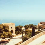
📷 Featured image by Carl Gruner on Unsplash.